

Residents of western Kewaunee County and southern Door can expect to hear the rotors of a low-flying helicopter in the coming months. The US Geological Survey will be doing aerial depth to bedrock measurements using an electromagnetic apparatus shaped like a torpedo. Traditionally, the work is done by hand using a manual drill, which is costly and cannot cover a large area. Counties tend to fund the work individually, leaving a patchwork of results featuring locations with great data bordering more incomplete information sets.
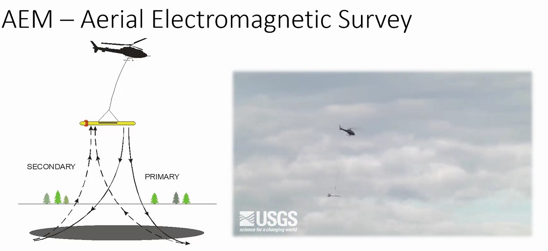
The work is being done by USGS, focusing on the western edge of the Niagara escarpment. Surveying is set from Fond du Lac to Sturgeon Bay. The bid is still out, meaning data collection won’t happen for a couple of months. Physical scientist Matt Komiskey presented to the Door County Land Conservation Committee on Thursday. The aerial method struggles with measurements where topsoil is extremely thin. Komiskey says that means Door County numbers could be unreliable and are meant to be only a part of the overall picture, along with other surveys.
Even in the southern end of the county, depth to bedrock is estimated at around 24 inches, or two feet. Aerial electromagnetic surveying has been used in industries such as oil and natural gas exploration to find new resource deposits. Komiskey says this is a more recent use for the innovative technology.