
The record temperatures you experienced Monday will be a distant memory this weekend, but road crews have already proven that they are ready for winter's return.
Much of Wisconsin will be in and out of winter storm advisories through Monday afternoon.
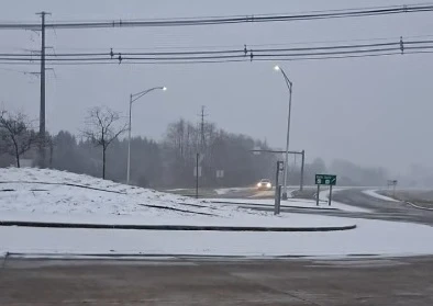
While different outlets cannot agree on how much snow could fall on the high end, meteorologists agree that no less than 6-12 inches will accumulate.
Kewaunee County Highway Department Commissioner Marty Treml says they were confident Mother Nature had another storm left before the calendar switched to spring. The blades are still on the trucks, and crews will be ready to clear the snow when the time arrives.
If the area does get the 20-plus inches some outlets are reporting, Treml urges motorists to stay off the roads so everyone can remain safe.
Even after the snow stops, Door County Highway Commissioner Thad Ash asks for patience. He estimates it will not be until Tuesday before the roads are cleared for safe driving.
According to the National Weather Service, several inches of snow fell Thursday night into Friday morning, including 3.5 inches in Sturgeon Bay and nine inches in Egg Harbor. There is still a high probability of 12 to 24 inches of snow Saturday night through Monday morning.