
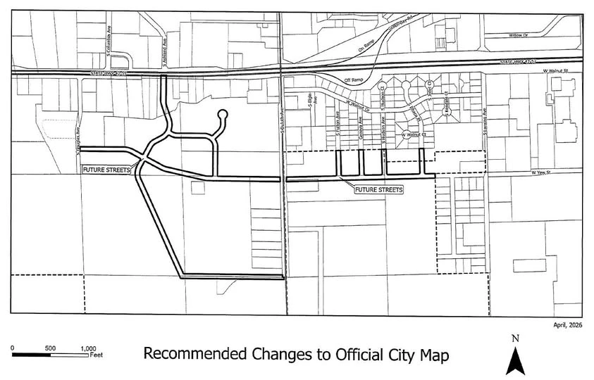
The Sturgeon Bay Plan Commission will hold a public hearing Wednesday on proposed updates to the city’s Official Map, including conceptual roadway layouts and long-term development planning for the west side.
The meeting begins at 6 p.m. in the Sturgeon Bay City Council Chambers. The proposal outlines potential future infrastructure improvements, including a possible extension of Ashland Avenue, conceptual roadway connections east of Douglas Avenue and west of South Ithaca Place, and planning areas north of the Door County Justice Center.
The Official Map is a planning tool allowed under Wisconsin law that helps municipalities identify future road corridors and infrastructure needs before development occurs. The concepts are intended to guide growth while reducing impacts to environmentally sensitive areas, including wetlands.
District 4 Alderman Spencer Gustafson said the discussion is part of long-range planning efforts for the city’s west side.
He added that public input is a key part of the process. "Nothing proposed is final construction approval. This hearing is about hearing from residents and making sure their concerns and ideas are part of the plan moving forward,” he said on a Facebook post.
The Plan Commission will take public comment before making a recommendation to the Common Council. Officials say the update could play a significant role in future traffic flow and development patterns on the city’s west side.